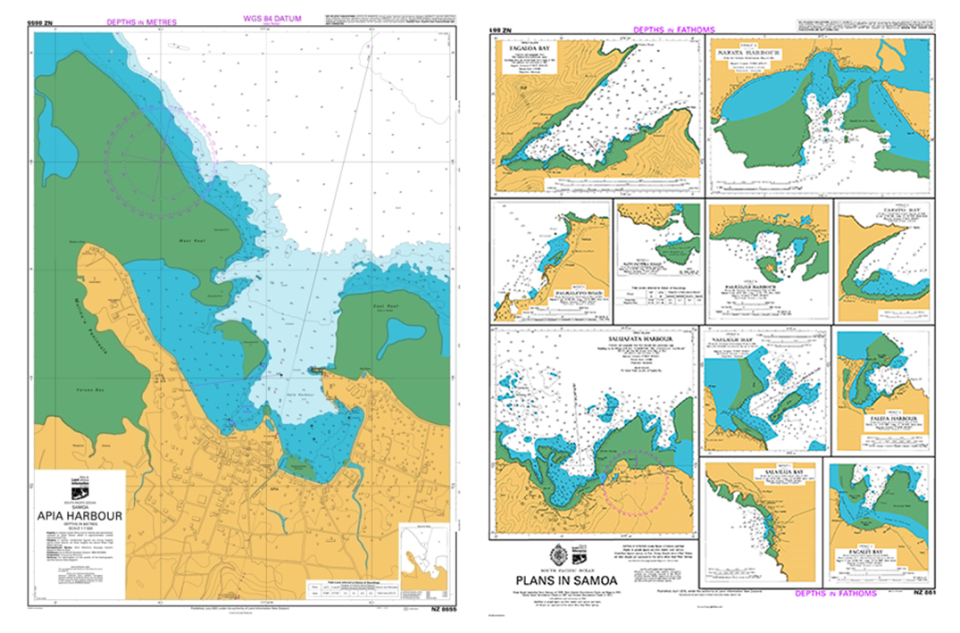
International Port of Apia is located at: Latitude: 13° 49′ 42″ S / Longitude: 171° 45′ 45″ W Chart No: 8655, Apia Harbour, Scale: 1:7500, Published: 7/2007 and Chart No: 861 (anchorages)
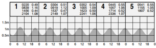
 Tide Tables and Annual Tide Calendars are in pdf format available by clicking image below:
